

28.02.2026 – A common day
March 5, 2026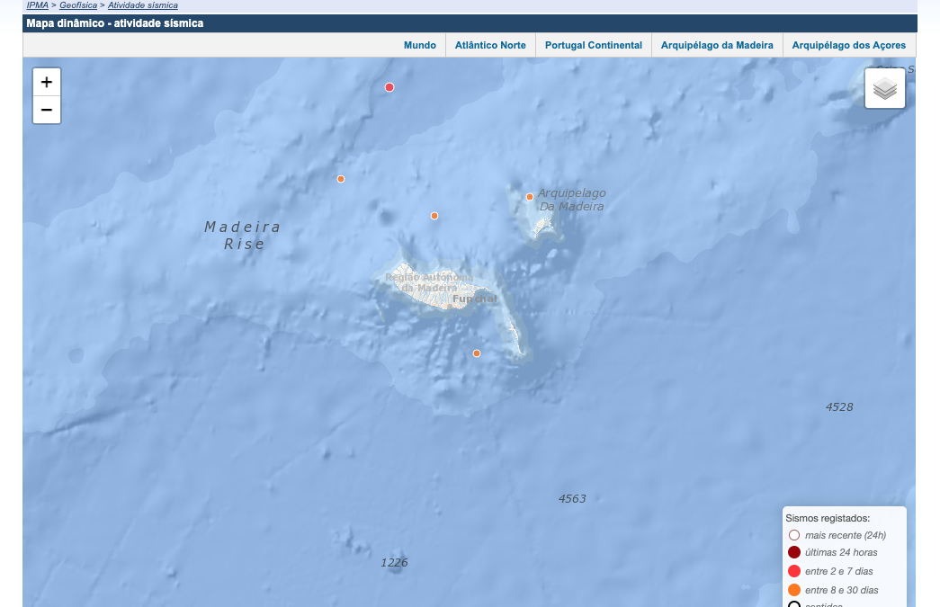
Madeira is located in the North Atlantic in a geologically active region shaped by the movement of tectonic plates. The island itself was formed by volcanic activity several million years ago, and even today the waters around Madeira still show signs of geological dynamics.
Seismic activity in Madeira’s waters is generally moderate, but occasionally minor earthquakes occur, triggered by movements along the boundary between the African and Eurasian plates. These tectonic tensions are a remnant of the island’s formation and of the surrounding volcanic island groups, which also include the Azores and the Canary Islands.
Occasionally, seismographs record underwater earthquakes, which, although rarely destructive, provide valuable information for scientific research on the region’s geology. Such activity can cause changes on the seafloor, including underwater eruptions or minor landslides, which can affect coastal areas.
Historically, there is evidence that Madeira has experienced minor seismic events, though they rarely caused damage to the island’s infrastructure. Monitoring seismic activity is now an important part of geological observation to identify potential risks early.
Seismic activity also contributes to the island’s diverse landscape. Underwater eruptions and volcanic processes over millennia have helped shape cliffs, fajãs, and steep slopes, giving Madeira its distinctive topography.
Overall, the waters around Madeira demonstrate that, despite its seemingly calm appearance, the island is part of a dynamic geological system. This activity serves as a reminder that volcanic and tectonic processes continue to shape the island and its surrounding marine environment today.
© Photo by IPMA
By Fatima Kutzschbach
